Waimanu Locations
The initial impression of Waimanu Valley is often one of profound isolation, a geographical pocket tucked away on the rugged northeast coast of Hawaiʻi Island, specifically within the Hāmākua district. This is not a location you simply drive to; its remoteness is the defining characteristic that protects its wilderness status, making it one of the last truly untouched areas in the Hawaiian Islands. Access is severely restricted, forcing the adventurous to rely on two primary, demanding means: a multi-day backpacking trip on foot or a flight via helicopter.
# Waipiʻo Approach
The threshold to Waimanu begins at the adjacent, equally famous Waipiʻo Valley. The trailhead for the passage to Waimanu—the Muliwai Trail—is accessed via the road leading to the Waipiʻo Valley Lookout. This lookout, located at the terminus of Highway 240 from Honokaʻa, is a crucial staging location. Parking here is often difficult due to its popularity, and leaving a vehicle for over 24 hours risks being towed. For overnight trekkers, an alternative parking spot exists at Waipiʻo Valley Artworks for a daily fee, though calling ahead to confirm availability is advised.
It is essential to understand the local regulations concerning the Waipiʻo Valley Road, as these directly impact how one reaches the Muliwai Trailhead. An emergency proclamation from the County of Hawaii has placed significant restrictions on this road, often limiting vehicle use to Hawaiʻi Island residents only. This has created a complex situation where out-of-state hikers may find the most direct route blocked for walking, or must resort to expensive private shuttle services to reach the valley floor just to begin the hike—a cost layered on top of the required state camping permits. For those not taking a shuttle, or for the return trip, the road itself is notorious: an impossibly steep path with an average grade of 25% that is rough and not recommended for standard rental vehicles.
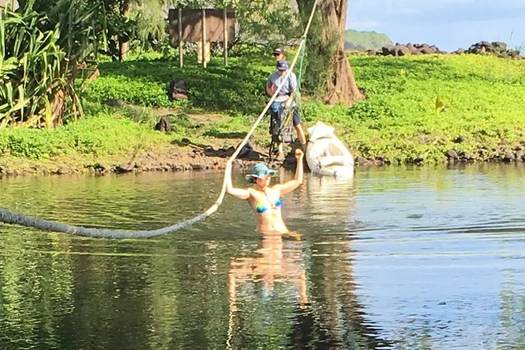
The true starting line for the Muliwai Trail is found after navigating down into Waipiʻo Valley, which requires crossing the Wailoa Stream where it meets the Pacific Ocean at the black sand beach. This initial river crossing is critical; attempting it during high tide is strongly discouraged due to treacherous conditions.
# Muliwai Trail Route
The Muliwai Trail itself is the primary connector location between Waipiʻo and Waimanu, representing the most substantial physical location on the approach. Hikers traversing this route often refer to it as the "Z Trail" due to its initial, brutal ascent. From the beach, the trail immediately begins a relentless switchbacking climb, gaining approximately 1,200 feet in less than a mile. This section demands careful footing, as the path is steep, eroded, and rocky, with a real risk of dislodging stones onto the path below.
Once the initial steep ascent is complete, the trail flattens somewhat as it traverses the Waipāhoehoe Plateau. This segment covers about 5.5 miles, winding through approximately twelve different gulches or stream crossings. While many of these are minor rock-hops, the area receives immense rainfall—over 100 inches annually—meaning any crossing can swell rapidly due to flash flood danger. The trail here can be less defined, sometimes leading through areas of introduced tree species like Ironwood, contrasting sharply with pockets of native forest featuring ohi'a and lama.
The total distance for the entire journey, measured from the Waipiʻo Valley Lookout parking area, is frequently cited as being around 19 miles round-trip. The cumulative elevation gain and loss across the ridges before the final descent into Waimanu is significant, testing endurance over a very long day if attempted without an overnight stay.

# Waimanu Valley Floor Locations
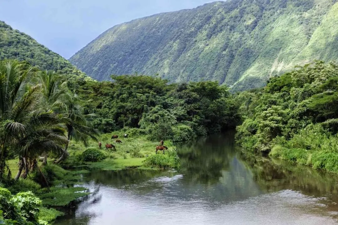
Upon completing the traverse across the plateau, the hiker faces the final descent into Waimanu Valley, which offers the first sweeping perspective of the destination, particularly of Waiʻilikahi Falls. The valley floor itself comprises several distinct and important locations for the visitor: the beach, the stream, the campsite area, and the interior waterfalls.
# The Bay and Campsite Area
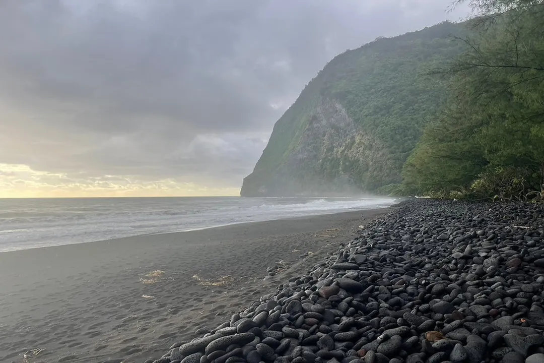
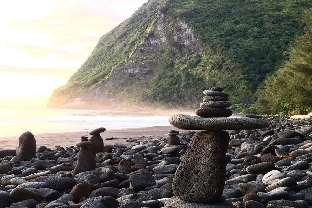
Waimanu Bay is where the Waimanu Stream empties into the ocean, creating the valley’s black sand beach. This shoreline is famed for its surreal isolation, lacking the development seen at more accessible beaches. The designated campsites—nine in total, accommodating up to 48 people—are situated near this beach area, requiring one final crossing of the Waimanu Stream to reach them.
The campsites themselves offer different positional advantages:
- Campsite 1 is nearest the stream.
- Campsite 2 is often highlighted for providing the best overall views of the valley amphitheater.
- Campsites 8 and 9 are favored by some for being furthest from other parties and closer to a reported spring water source. Site 9 is also positioned closer to the beachfront.
A geological feature unique to this region of the Kohala Mountain watershed involves a system of hard lava rock dikes, which efficiently funnel vast amounts of groundwater from the persistent tradewinds into the valley, ensuring a reliable water supply year-round, a key reason the valley historically supported large populations. However, campers must treat all water due to potential contaminants like Leptospirosis. Furthermore, the bay itself presents a hazard, as high surf can occasionally flood the campground grounds.
# Interior Waterfalls
Venturing inland from the beachhead unlocks the valley’s most spectacular geological features. The exploration of these interior locations is what often necessitates a multi-day stay, as the mileage between them is short but the terrain becomes increasingly overgrown and challenging.
The waterfall locations, in order moving up the valley from the beach area, include:
- Waiʻilikahi Falls: Generally the first major waterfall reached, situated about 1.2 miles up the valley from the campsites. It features a notable two-drop cascade.
- Kākāʻaukī Falls: Located roughly 1 mile beyond Waiʻilikahi, reaching this spot involves contouring a hillside and following a stream up to its pool. This area is reportedly known for wild orange trees.
- Lahomene Falls: Only about 0.8 miles past Kākāʻaukī Falls, this final waterfall on one popular itinerary involves following the stream bed directly.
Beyond Lahomene, the valley contains Waihīlau Falls, which is renowned as one of the tallest single-drop waterfalls in the entire United States, descending from about 3,000 feet elevation. Reaching Waihīlau is substantially more difficult than the preceding falls, and hikers must meticulously plan the time required to return before dark. The very existence of these towering falls is due to the same geological structure—the dikes—that captures the moisture flowing down from the Kohala Mountain.
# Comparative Logistical Analysis
When planning a trip to Waimanu, the decision hinges on navigating access points, specifically comparing the physical cost of hiking versus the financial cost of alternative entry methods. While the Muliwai Trail is cited as a roughly 16-mile round trip by some accounts (when factoring in the descent/ascent into Waipiʻo), making it an extremely difficult one-day hike, camping for a minimum of three days is recommended to truly recover and explore the valley’s interior features like the farther waterfalls.
The logistical friction at the Waipiʻo end presents a key point of comparison for the overall location experience. For non-residents, the required shuttle to cross Waipiʻo Valley floor is substantially more expensive than the camping permit itself, creating an artificial barrier to access that the Muliwai Trail alone (with its inherent physical difficulty) did not impose before these vehicle restrictions.
| Location Component | Primary Hazard/Condition | Typical Travel Time (One Way) | Permit/Cost Factor |
|---|---|---|---|
| Waipiʻo Valley Road | 25% Grade, Resident Vehicle Restriction | N/A (Road access) | High (Shuttle/Permit/Parking) |
| Wailoa Stream Crossing | Flash Flood Danger, Tidal Influence | Minutes | Low (Tidal planning) |
| Waipāhoehoe Plateau | 12+ Stream Crossings, Slippery Footing | ~5.5 miles on Plateau | N/A |
| Waimanu Campsites | High Surf, Wildlife Encounters | End of Trail | Mandatory Reservation |
| Interior Waterfalls | Overgrowth, Remoteness | Increasing difficulty past Waiʻilikahi | Time & Energy Investment |
A tactical approach to the interior waterfall locations involves recognizing a decreasing return on effort versus time. Waiʻilikahi is relatively accessible, while the trek to Kākāʻaukī and then Lahomene demands progressively more navigational skill and energy, especially when attempting them on the same day one is packing up camp. If time is limited, prioritizing Waiʻilikahi and Kākāʻaukī, given the rewards of fruit gathering nearby, might be more strategic than pushing to the upper reaches of Waihīlau.

# Environmental and Historical Footprints
The landscape of Waimanu Valley reflects a history molded by both human presence and powerful natural forces. Geologically, Waimanu, along with Waipiʻo, Honopue, and others, was formed by a combination of volcanic faulting and stream erosion when sea levels were significantly lower. The current flat valley floors resulted from the subsequent rise in sea levels. Historically, Waimanu was an ahupuaʻa, a division of land that sustained a small village, with evidence of ancient Hawaiian occupation remaining, particularly around the cultivation of kalo (taro). The last inhabitants were reportedly forced out by a tsunami in 1946.
The valley's name, Waimanu, translates to "bird water" or "river of birds," underscoring the area’s rich avian life. The ecosystem is lush, featuring native flora such as the ubiquitous Hala tree, whose leaves can be dried and used for fire-starting material. The sheer volume of water flowing from the cliffs means the valley floor is often damp, which complicates the act of starting a fire for cooking.
The experience of reaching this remote location, a place where nature undeniably rules, instills a sense of accomplishment that few other Big Island hikes can match. The contrast between the arduous, exposed ridgelines of the Muliwai Trail and the sheltered, fruit-laden, waterfall-fed environment of the valley floor is striking. To simply exist in a location so far removed from modern infrastructure, where the only nighttime illumination comes from the Milky Way, solidifies Waimanu as a benchmark for true wilderness immersion in Hawaii.
While the environmental challenges—slippery rocks, falling branches, flash floods—are well-documented, the isolated nature of Waimanu also necessitates awareness of potential human encounters. Reports suggest that visitors should maintain group cohesion and secure their campsite area, given anecdotes of unpermitted individuals aggressively occupying sites or even trail harassment, suggesting that vigilance regarding personal safety is as important as monitoring the weather. Respecting the physical locations—staying on the trail, honoring permit boundaries, and practicing Leave No Trace principles—is paramount to preserving this rare, rugged paradise.
Related Questions
#Citations
Waimanu Campsite - Hawaii Camping Reservation
Waimanu Valley
Waimanu Valley, Hawaii
Hawaii: Waimanu Valley
Waimanu Valley
Hiking the Muliwai Trail to Waimanu Valley on the Big ...
Waimanu Valley: Hawaii's Last True Wilderness
11 Off The Beaten Path Places To Put On Your Camping ...
Remote valley with waterfalls on Hawaii Island, United States
Waimanu Valley: A Hidden Gem for Hike Hawaii Big Island